

Intipata: The Terraces of the Sun Before Machu Picchu
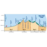
A little over two kilometers south of Machu Picchu, between the sites of Wiñaywayna and Intipunku, the Inca Trail 4 days passes by Intipata: a striking set of agricultural terraces carved into the mountainside that, even from a distance, is one of the most photographed sights on the entire route.
What Is Intipata?
The name Intipata comes from two Quechua words: "inti" (sun) and "pata" (place or terrace), usually translated as "terrace of the sun" or "place of the sun." The name reflects both its main function — agriculture, closely tied to sun worship in the Inca worldview — and its privileged sun-facing orientation.
Intipata was, above all, a center of agricultural production: its more than 40 terraces, some over two meters tall, were used to grow corn, quinoa, potatoes, and even coca leaf. Thanks to its position high on the mountain, the site also served as a control and watch post, from which it was possible to observe travelers heading toward Machu Picchu.
Architecture: Levels for Each Social Class
Intipata is organized into clearly differentiated levels. The lower, simpler structures were meant for the common population, while the upper ones — with finer stonework and windows facing the landscape — would have been occupied by the Inca elite. The urban centers sit at the top of the site, while a ceremonial precinct at the bottom was used for rituals dedicated to Pachamama.
Intipata's irrigation system is another of its great attractions: the water channels that irrigated the various terraces were so sophisticated that some still function today. On a sloped section of the site, a set of liturgical fountains has also been preserved, linked to the same water cult found at other Inca Trail sites.
An Agricultural Project Shared With Wiñaywayna
Intipata wasn't an isolated site: together with neighboring Wiñaywayna, it was part of a single Inca state project aimed at expanding the agricultural frontier along the eastern flank of the Andes. This proximity explains why both sites share such a strongly productive character, distinct from the more administrative or ceremonial profile of other points on the route, such as Phuyupatamarca or Sayacmarca.
Visible From the Whole Route, but Hard to Reach
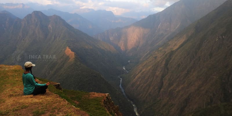
Even when you don't walk directly among its terraces, Intipata is visible from several stretches of the Inca Trail, and its presence in the landscape — with stepped terraces covering the mountainside — is one of the most repeated visual memories among those who complete the trek.
A Transitional Setting
Intipata sits in the transition zone between the Andean highlands and the high jungle, reflected in especially diverse vegetation. This kind of landscape, straddling two ecosystems, is characteristic of the entire final stretch of the Inca Trail, between Phuyupatamarca and Wiñaywayna.
Location and How to Get There
Intipata sits within the Machu Picchu Historic Sanctuary, between the sites of Wiñaywayna and Intipunku (the Sun Gate), about 2.5 km south of Machu Picchu. There's no vehicle access: it can only be visited on foot, as part of the final stretch of the classic Inca Trail, either as a brief stop or a view from the trail.
Reference location of Intipata, Machu Picchu Historic Sanctuary, Cusco.
Other Stops Near Intipata
Phuyupatamarca
The "town above the clouds," from where Intipata can be seen in the distance.
Wiñaywayna
The last campsite before Machu Picchu, very close to Intipata and sharing a common agricultural origin.
Intipunku
The Sun Gate, the final entry point into Machu Picchu from the Inca Trail.
Discover the Terraces of Intipata on Your 4-Day Inca Trail Trek
Intipata is one of the most striking landscapes on the final stretch toward Machu Picchu. Check out the full itinerary, available dates, and everything included in our classic Inca Trail tour.