Pacaymayo: The Cloud Forest Camp After Dead Woman's Pass
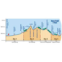
After conquering Warmiwañusca, the highest point on the Inca Trail 4 days, the trail descends into Pacaymayo: the highest-elevation campsite on the entire route and, for many hikers, the place where they finally get to celebrate having survived the trek's toughest day.
What Is Pacaymayo?
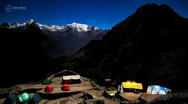
Pacaymayo is the second campsite of the classic Inca Trail and, at 3,600 meters (11,811 ft), the highest of the entire route. It sits on the floor of the valley of the same name, right after the steep descent that follows the summit of Warmiwañusca, and takes its name from the river running through the area.
The name "Pacaymayo" comes from Quechua and means "river of the pacae trees," referring to the pacae, a native fruit tree whose white pods are characteristic of the montane forest in this part of the Andes. The river that gives the campsite its name flows directly down from nearby glaciers, keeping its waters cold and clear year-round.
The Descent from Warmiwañusca
Reaching Pacaymayo means having already conquered the toughest climb on the Inca Trail. After a well-earned rest at the top of the pass, the trail descends steeply — nearly 1,000 meters of elevation loss — combining stone staircases carved by the Incas with more uneven stretches. The full descent from the summit of Warmiwañusca to the campsite typically takes between an hour and a half and two hours.
It's a descent that demands attention, especially to protect your knees after the effort of the climb, but it also brings a striking change of scenery: the dry, windswept high puna gradually gives way to an increasingly green, humid forest.
A Campsite Wrapped in Cloud Forest
Pacaymayo sits completely surrounded by dense cloud forest vegetation: tree ferns over three meters tall, moss covering every rock and fallen trunk, and wild orchids that bloom on low branches year-round. It's a striking contrast to the more exposed, colder landscape of the pass just crossed.
The campsite sits near a small lake of the same name, and on clear days it's possible to make out the Salkantay and Pumasillo peaks rising above the surrounding vegetation.
A Night to Recharge
After a physically demanding day, arriving at Pacaymayo tends to feel like a genuine celebration. Under a starry sky that feels especially close in this area, many groups share stories around camp while the sound of the Pacaymayo River accompanies the night. Sleeping well here largely depends on arriving well hydrated, eating a proper dinner, and packing your bag for the next day before turning in, since Day 3 usually starts early, between 6:00 and 7:00 a.m.
What Comes Next: The Most Archaeological Day
Day 3 of the Inca Trail, which departs from Pacaymayo, is generally considered the richest in archaeological sites and also one of the longest, though physically less demanding than the Warmiwañusca day. The route continues to the Runkurakay pass, followed by the ruins of Sayacmarca and Phuyupatamarca, before descending toward Wiñaywayna, the last campsite before Machu Picchu.
Location and How to Get There
Pacaymayo sits in the valley of the same name, in the Vilcabamba mountain range, within the Machu Picchu Historic Sanctuary, right after the descent from the Warmiwañusca pass. There's no vehicle access: it can only be reached on foot, as part of Day 2 of the classic Inca Trail.
Reference location of Pacaymayo, Pacaymayo valley, Vilcabamba mountain range, Cusco.
Why This Night Feels Different
Pacaymayo arrives at exactly the right moment in the trek: right after the biggest physical challenge of the Inca Trail, and right before the day with the most history and archaeology. That combination — the relief of having conquered Warmiwañusca, the cloud forest setting, and a well-earned rest — makes this one of the nights hikers remember most.
Other Stops Near Pacaymayo
Warmiwañusca (Dead Woman's Pass)
The highest point on the Inca Trail, crossed just before the descent into Pacaymayo.
Runkurakay
The trail's second mountain pass, visited on the morning of Day 3.
Sayacmarca
The archaeological site known as "the inaccessible town," visited shortly after Runkurakay.
Sleep at Pacaymayo After Conquering Warmiwañusca
Pacaymayo is the reward after the Inca Trail's toughest day. Check out the full itinerary, available dates, and everything included in our classic Inca Trail tour.